Come on in and grab a raffle ticket to support the Teen Night @ the Kelsey Centre. $10 per ticket or 3 for $20. Prize an original painting my local artist Buddy Logan.
See you and your little goblins later for trick or treating…
We have a small but super mighty team and we need them healthy:)


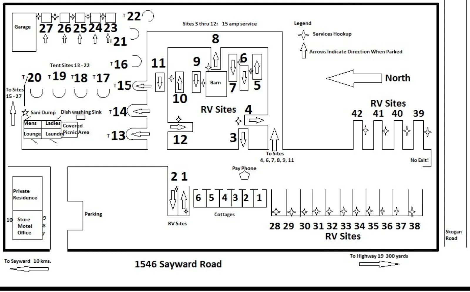
.jpg)